
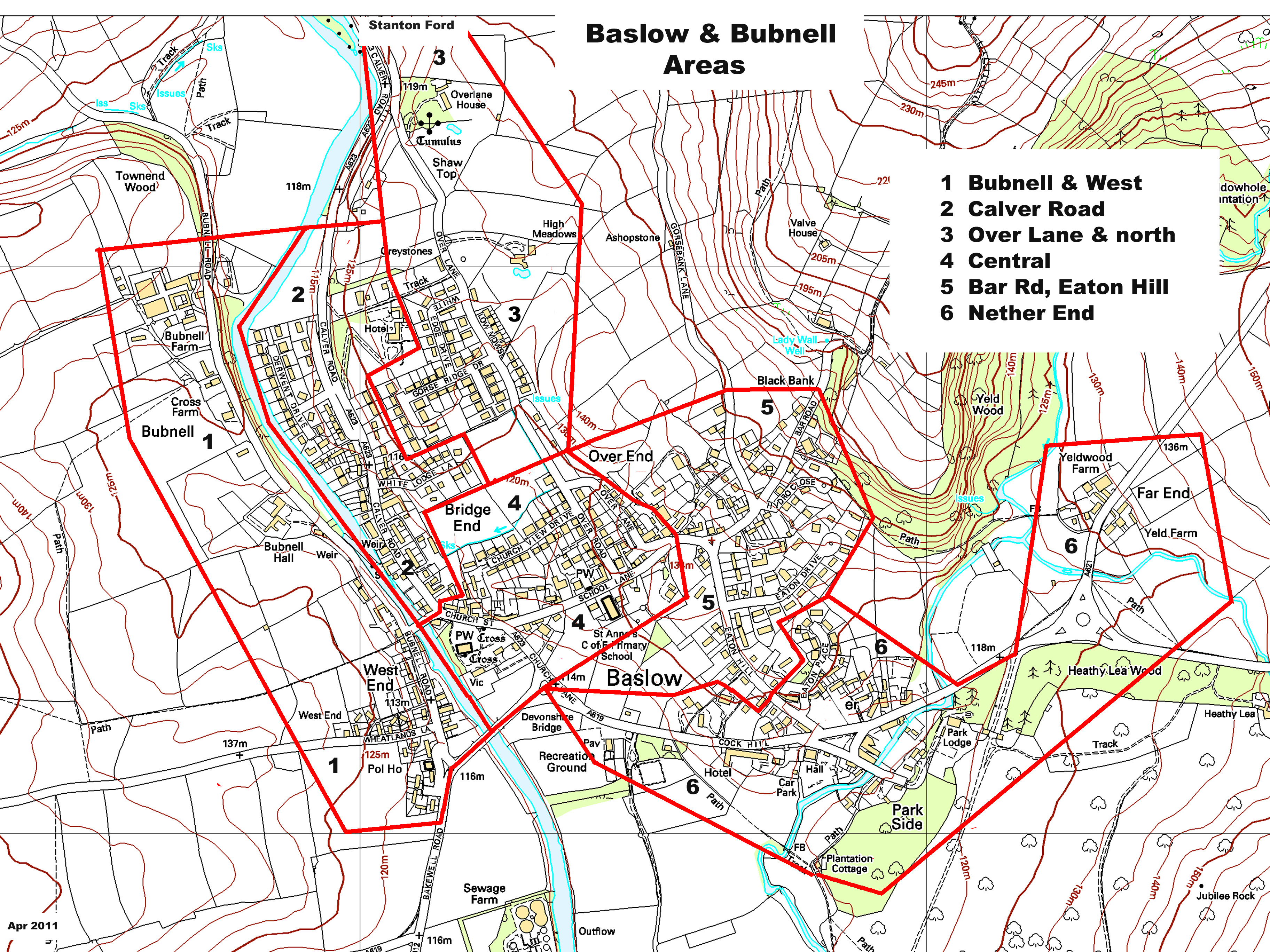
Baslow and Bubnell is the official name of the village, frequently abbreviated to Baslow. The first part is Baslow, which is all of the land to the east of the river, and also land west of the river south ofthe Old Bridge. The other small part is Bubnell which is west of the river and north ofthe old bridge. Bubnell Lane is part in Bubnell and part in Baslow
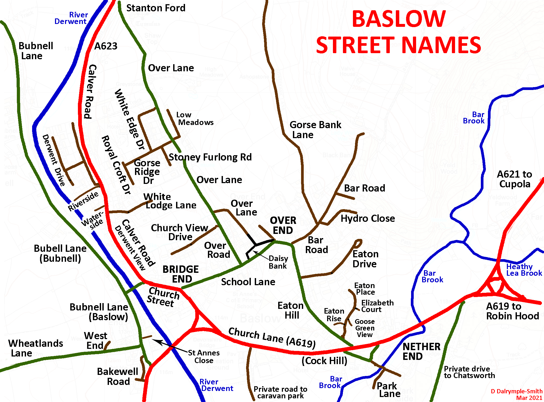
7.1aa Map of Baslow A simple map with all the streets in the village clearly named

7.1ab Map of Baslow (click on the icon) is similar, taken from the Open Street Map
If you are distributing leaflets, you will find the 7.1ac Street List for Circulars useful. It is a list of the streets with the numbers of houses in each, with a choice of two maps for guidance 7.1ad Circs Map 1 or 7.1ae Circs Map 2. The list also includes the names of the houses in the parish outside the village perimeter.
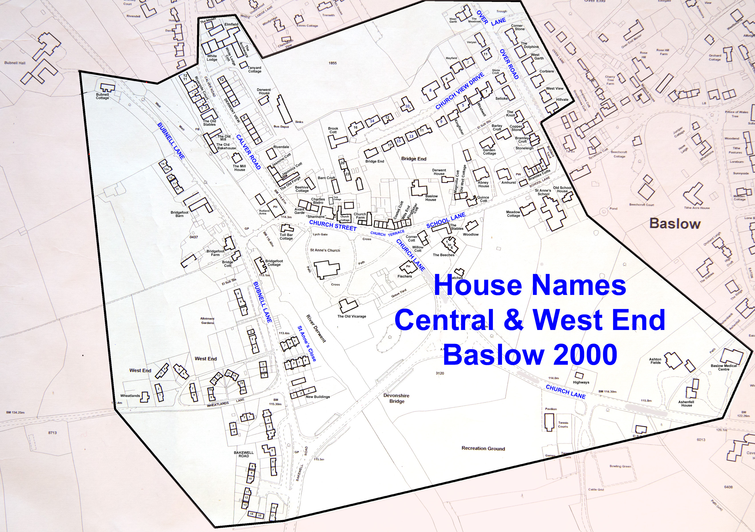
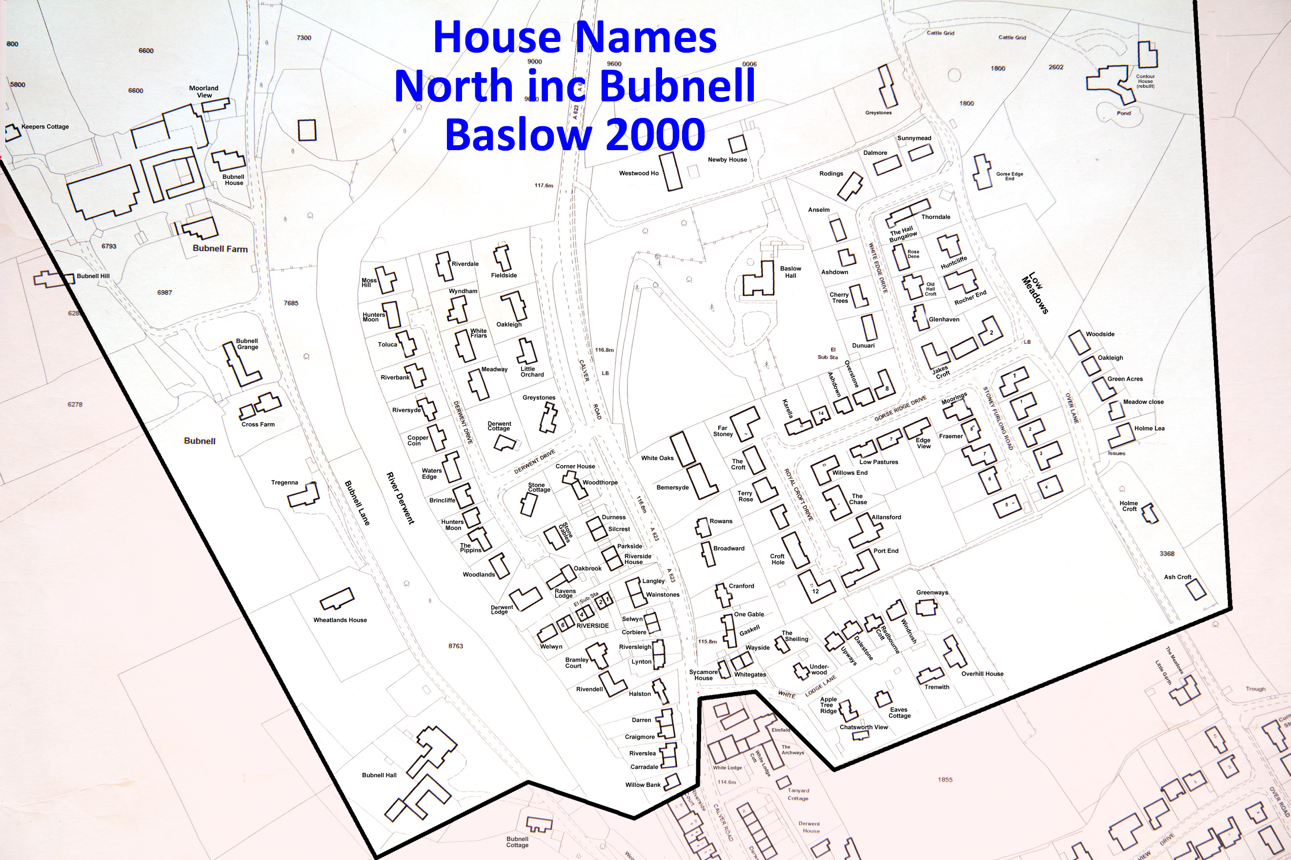
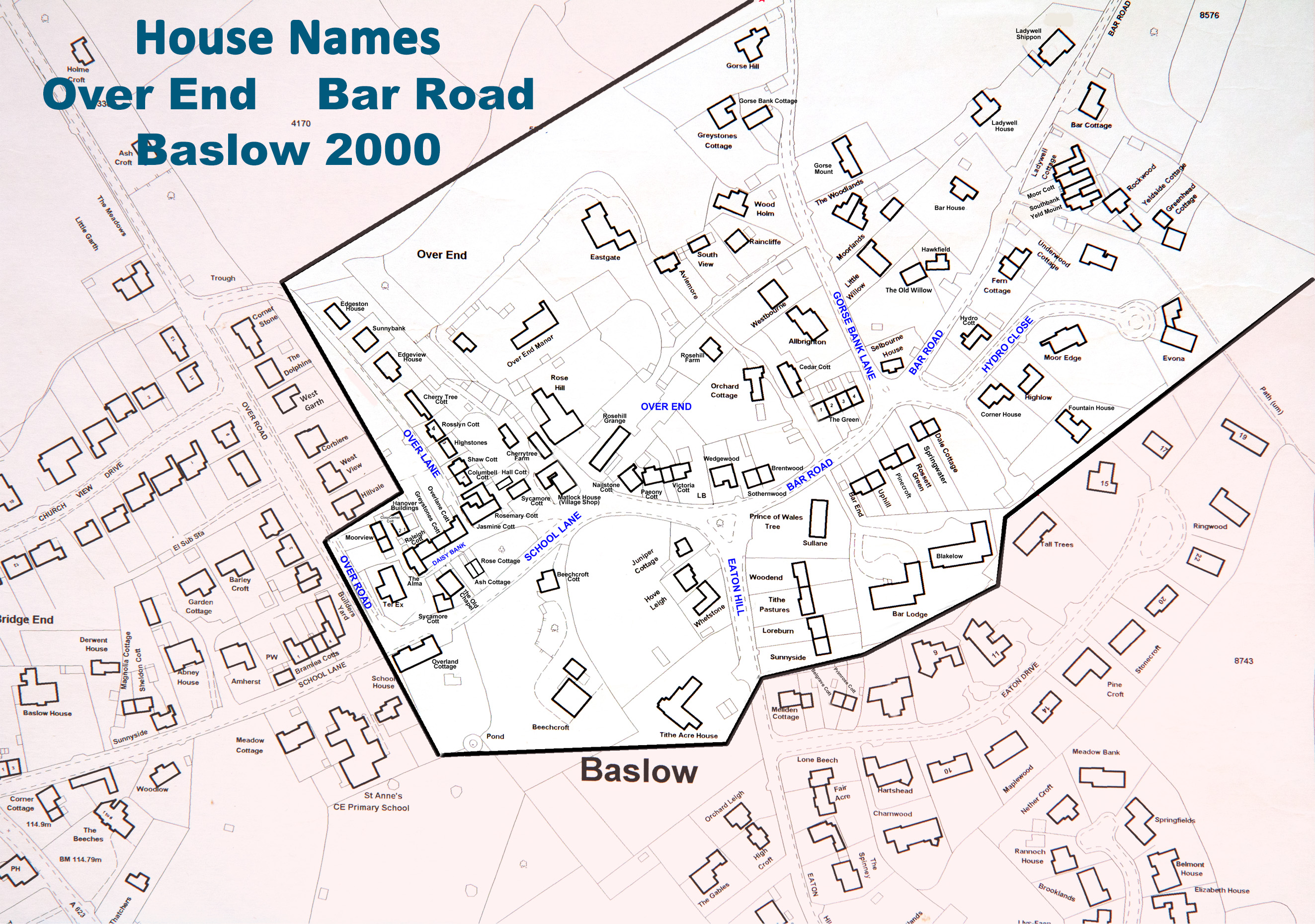
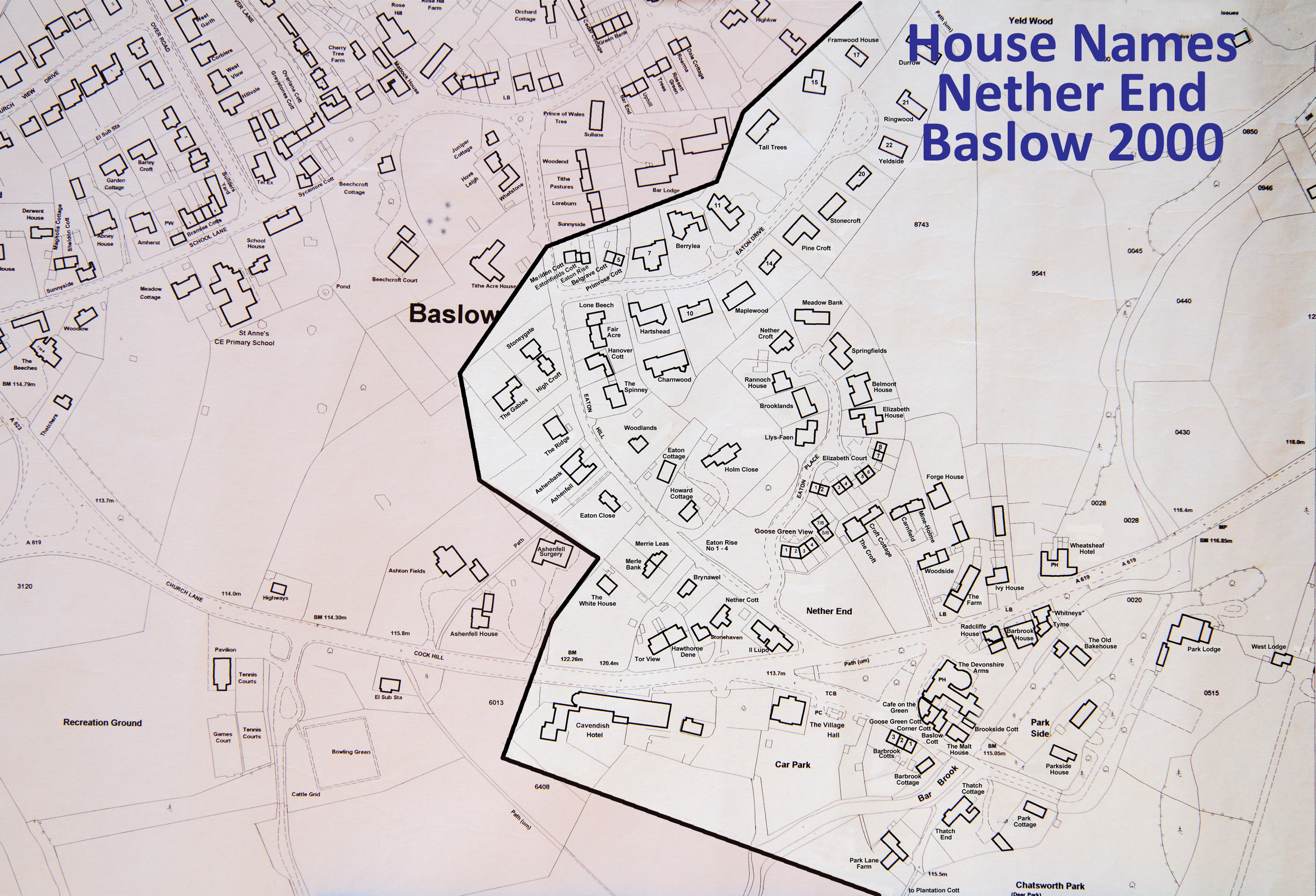
7.1b MAPS with house names
These are large scale maps with each house named. You can use them to find the site of a specific house in the village
7.1ba West End & Central 7.1bb Bubell & North 7.1bc Over End & Bar Rd 7.1bd Nether End
Please note house names can change. These were correct around 2010.
An ariel photograph of Baslow from Google Maps taken in 2015 or thereabouts

