Baslow History
Much information about Baslow collected by David Dalrymple-Smith
Skip to content
HOME
0 Contents
1 The Church
1.1 Church of St Anne Building
1.2 Memorial Inscriptions
1.3 The Baslow Charities
1.4 The Methodist Church
2 My Articles
2.1 Village History + Chatsworth
2.2 Village Growth
2.3 Schools & Shops
2.4 Village industry
2.5 Places of interest
2.6 Map series
3 Other Authors
3.1 Older Documents pre 1900
3.2 History collections
3.3 Other Authors pre 2000
3.4 Other Authors recent
3.5 Ann Hall
4 Census & Tithe
5 Gazetteers & Events
6 Baslow Families
6.1 Family Trees
6.2 Family Notes
7 Maps Houses Sales
7.1 Maps & Streets
7.2 Houses
7.3 Sales
8 Misc
9 GALLERY
9a The Church images
9b Pubs and Inns
9c Schools
9d Bridges
9e Millstones
9f Lead Smelting
9g Coal Mining
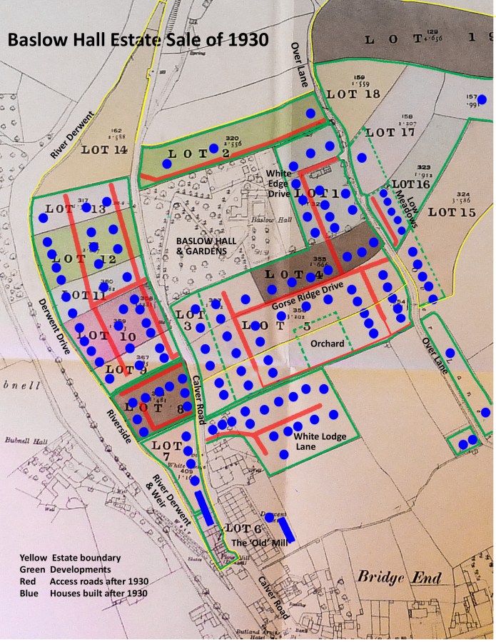
Ferranti Est plan
By
David Dalrymple-Smith
|
Published
November 13, 2017
|
Full size is
2244 × 2905
pixels
OS Maps: online mapping and walking, running and cycling routes
OS Maps: online mapping and walking, running and cycling routes
Bookmark the
permalink
.
Baslow History
Sign up
Log in
Copy shortlink
Report this content
Manage subscriptions

